
  | Huylenbroeck, L. (2024). Remote sensing applications for the characterization and management of riparian vegetation in Southern Belgium [Doctoral thesis, ULiège. GxABT - Liège Université. Gembloux Agro-Bio Tech]. ORBi-University of Liège. https://orbi.uliege.be/handle/2268/315642 |
 | Georges, B., Michez, A., Piégay, H., Huylenbroeck, L., Lejeune, P., & Brostaux, Y. (2021). Which environmental factors control extreme thermal events in rivers? A multi-scale approach (Wallonia, Belgium). PeerJ. doi:10.7717/peerj.12494  Peer Reviewed verified by ORBi Peer Reviewed verified by ORBi |
 | Huylenbroeck, L., Latte, N., Lejeune, P., Georges, B., Claessens, H., & Michez, A. (20 March 2021). What Factors Shape Spatial Distribution of Biomass in Riparian Forests? Insights from a LiDAR Survey over a Large Area. Forests, 12 (371). doi:10.3390/f12030371 Peer Reviewed verified by ORBi |
 | Georges, B., Claessens, H., De Coster, A., Desteucq, O., Englebert, B., Huylenbroeck, L., & Michez, A. (2020). Une approche intégrée et sectorisée de la gestion des cours d’eau wallons : les PARIS. Forêt.Nature, (157), 18-28. |
 | Michez, A., Huylenbroeck, L., Bolyn, C., Latte, N., Bauwens, S., & Lejeune, P. (01 October 2020). Can regional aerial images from orthophoto surveys produce high quality photogrammetric Canopy Height Model? A single tree approach in Western Europe. International Journal of Applied Earth Observation and Geoinformation, 92, 102190. doi:10.1016/j.jag.2020.102190 Peer Reviewed verified by ORBi |
 | Huylenbroeck, L.* , Laslier, M.* , Dufour, S., Georges, B., Lejeune, P., & Michez, A. (01 August 2020). Using remote sensing to characterize riparian vegetation: a review of available tools and perspectives for managers. Journal of Environmental Management, 267. doi:10.1016/j.jenvman.2020.110652 Peer Reviewed verified by ORBi* These authors have contributed equally to this work. |
  | Georges, B., Brostaux, Y., Claessens, H., Degré, A., Huylenbroeck, L., Lejeune, P., Piégay, H., & Michez, A. (01 July 2020). Can water level stations be used for thermal assessment in aquatic ecosystem? River Research and Applications, 36 (6), 960-973. doi:10.1002/rra.3520 Peer Reviewed verified by ORBi |
 | Huylenbroeck, L., Michez, A., Claessens, H., & Desteucq, O. (2020). Le « Guide de gestion des ripisylves » mis à jour. Forêt.Nature, 155 (Avril - juin 2020), 61-69. |
Huylenbroeck, L., Michez, A., & Lejeune, P. (2019). Supporting river management with UAV’s in the Provinces of Liège and Luxembourg [Paper presentation]. ID2MOVE - Séminaire académique sur les systèmes autonomes, Nivelles, Belgium. |
 | Lejeune, P., Gorel, A., Dupuis, C., & Huylenbroeck, L. (2019). QGIS 09 - Géotraitements en mode vectoriel avec QGIS. (ULiège - Université de Liège). |
 | Lejeune, P., Gorel, A., Dupuis, C., & Huylenbroeck, L. (2019). QGIS 05 - Les mises en page avec QGIS. (ULiège - Université de Liège). |
 | Lejeune, P., Gorel, A., Dupuis, C., & Huylenbroeck, L. (2019). QGIS 10 - Géotraitements en mode raster avec QGIS. (ULiège - Université de Liège). |
 | Lejeune, P., Gorel, A., Dupuis, C., & Huylenbroeck, L. (2019). QGIS 03 - Gestion des tables dans QGIS. (ULiège - Université de Liège). |
 | Lejeune, P., Gorel, A., Dupuis, C., & Huylenbroeck, L. (2019). QGIS 11 - Utilisation de Web Services dans QGIS. (ULiège - Université de Liège). |
 | Lejeune, P., Gorel, A., Dupuis, C., & Huylenbroeck, L. (2019). QGIS 06 - Digitalisation de couches vectorielles avec QGIS. (ULiège - Université de Liège). |
 | Lejeune, P., Gorel, A., Dupuis, C., & Huylenbroeck, L. (2019). QGIS 08 - Géoréférencement d'un fichier raster avec QGIS. (ULiège - Université de Liège). |
 | Lejeune, P., Gorel, A., Dupuis, C., & Huylenbroeck, L. (2019). QGIS 07 - Gestion du GPS et connexion avec QGIS. (ULiège - Université de Liège). |
 | Huylenbroeck, L., Michez, A., & Claessens, H. (2019). Guide de gestion des ripisylves. Namur, Belgium: Service Public Wallonie. |
 | Lejeune, P., Gorel, A., Dupuis, C., & Huylenbroeck, L. (2019). QGIS 04 - Gestion de la symbologie dans QGIS. (ULiège - Université de Liège). |
 | Huylenbroeck, L., Georges, B., Claessens, H., Lejeune, P., & Michez, A. (07 June 2018). Estimation du volume de bois des forêts riveraines afin d’enappuyer la gestion : Approche par télédétection sur un linéaire étendu (230 km) [Paper presentation]. IS Rivers 2018, Lyon, France. |
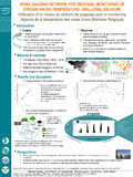 | Georges, B., Hervé, P., Huylenbroeck, L., Lejeune, P., Brostaux, Y., & Michez, A. (June 2018). Using gauging network for regional monitoring of stream water temperature (Wallonia, Belgium) [Poster presentation]. International conference I.S.Rivers 2018 - integrative sciences and sustainable development of rivers, Lyon, France. |