Classification of riparian forest species (individual tree level) using UAV-based Canopy Height Model and multi-temporal orthophotos (Vielsalm, Eastern Belgium)
UAV; Random forest classification; multi-temporal imagery
Abstract :
[en] Introduction :
Despite their relatively low area coverage, riparian forests are central landscape features providing several ecosystem services. Nevertheless, they are critically endangered in European countries by human pressures (livestock grazing, land use conflicts, canalizations, waste water, ...) andalso by natural hazards such as the recent black alder (Alnus glutinosa) extensive decline caused by Phytophthora alni.
In this study UAV is used to improve the characterization of riparian areas. Riparian forest species are identified at the individual tree level. The health condition of black alder is assessed.
For this purpose a computer based approach has been developped, with low needs of specific operator ability or training.
Methods :
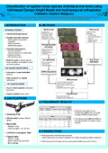
We used the Gatewing X100 to acquire 16 aerial photographs datasets (7 in classic RGB and 9 in RG NIR) during 5 days (form Augustus to October 2012). We processed a CHM in ArcGIS by combining a national Digital Terrain Model with a photogrammetric DSM generated from a single flight photographs dataset with the "MicMac" opensource platform. The 16 orthophotos were computed with Agisoft Photoscan.
Based on the CHM and some basic vegetation index (mean NDVI), a classification/segmentation process was developped in eCognition allowing tree crown extraction. An amount of 113 metrics were computed in eCognition for every tree crown object. The metrics were both derived from the CHM raster and spectral information. Metrics were computed by band (object spectral mean and CHM mean, Harralick entropy, Skewness) but also with band combination (Green NDVI and NDVI).
A reference dataset was also acquired through a field survey of 624 individual tree positions accurately localized. The health condition of the black alder was recorded during the field survey.
A supervised classification algorithm was developed in R (Random Forest package).
Results :
Several classification trees were assessed trough global accuracy using the Out Of Bag (OOB) error.
The best global accuracy (82%) was obtained when distinguishing the black alder (with no regards for health condition during field survey) from the rest of riparian forest objects. The global accuracy tended to decline when other species were added.
When separating healthy black alders from those with symptoms, the global accuracy is 77%.
Conclusions :
Our study highlights the potential of UAV-based multitemporal orthophotos to identify riparian forest species and health conditions at the tree level. Future studies will focus on quick radiometrics corrections. This could improve global accuracy by reducing the variability caused by illumination conditions
Disciplines :
Life sciences: Multidisciplinary, general & others
Author, co-author :
Michez, Adrien ; Université de Liège - ULiège > Forêts, Nature et Paysage > Gestion des ressources forestières et des milieux naturels
Lisein, Jonathan ; Université de Liège - ULiège > Forêts, Nature et Paysage > Gestion des ressources forestières et des milieux naturels
Toromanoff, François ; Université de Liège - ULiège > Forêts, Nature et Paysage > Gestion des ressources forestières et des milieux naturels
Bonnet, Stéphanie ; Université de Liège - ULiège > Forêts, Nature et Paysage > Gestion des ressources forestières et des milieux naturels
Lejeune, Philippe ; Université de Liège - ULiège > Forêts, Nature et Paysage > Gestion des ressources forestières et des milieux naturels
Claessens, Hugues ; Université de Liège - ULiège > Forêts, Nature et Paysage > Gestion des ressources forestières et des milieux naturels
Language :
English
Title :
Classification of riparian forest species (individual tree level) using UAV-based Canopy Height Model and multi-temporal orthophotos (Vielsalm, Eastern Belgium)
Alternative titles :
[fr] Classification (niveau arbre) des espèces des forêts rivulaire à l'aide de Modèle Numérique de Canopée et de séries temporelles d'orthophoto dérivée de données drone (Vielsalm, Ardenne belge)
Publication date :
09 September 2013
Event name :
Workshop on UAV-based Remote Sensing Methods for Monitoring Vegetation
Event place :
Cologne, Germany
Event date :
du 09 au 10 septembre 2013
Audience :
International
Funders :
SPW DG03-DGARNE - Service Public de Wallonie. Direction Générale Opérationnelle Agriculture, Ressources naturelles et Environnement [BE]